In 2021, Government announced that Scarborough was successful in securing £20 million in Town Deal funding, to regenerate the area and deliver long-term economic growth.
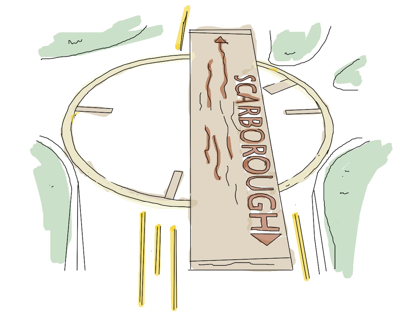
Eight projects being funded are designed to make the town more vibrant and build on the cultural heritage. One of these projects is the Scarborough Local Cycling and Walking Infrastructure (Cinder Track Improvements).
We are planning to improve the Cinder Track gateways between Scalby and Scarborough by installing junction safety improvements, enhanced landscape diversity and create public space for the benefit of both local communities and visitors.
Before we carry out any improvements, we are asking people to share their views on our proposals.
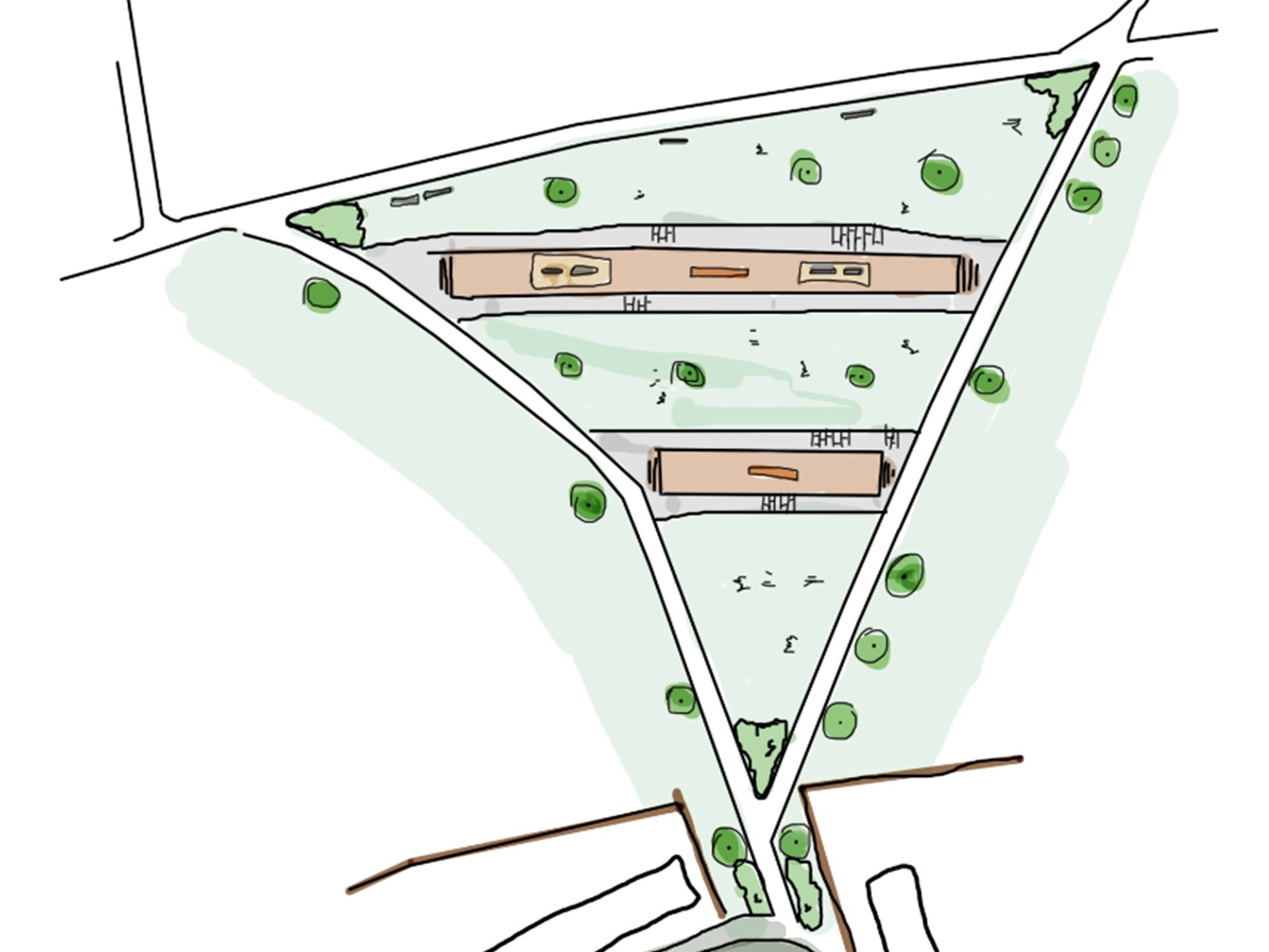
The gateway project has been split into different areas with each area is inspired by the idea of rail travel. Some areas are inspired by railway platforms (places to rest), some are considered destination or 'gateway' areas (start or finish points), and others are designed as spaces that are journeyed through to get to a destination.
This project is separate to the Cinder Track improvement scheme that is currently being carried out in phases, with the next phase taking place between Burniston and Cloughton in the coming months.
Take part in the Cinder Track gateway consultation
Closing date is Monday 9 September.
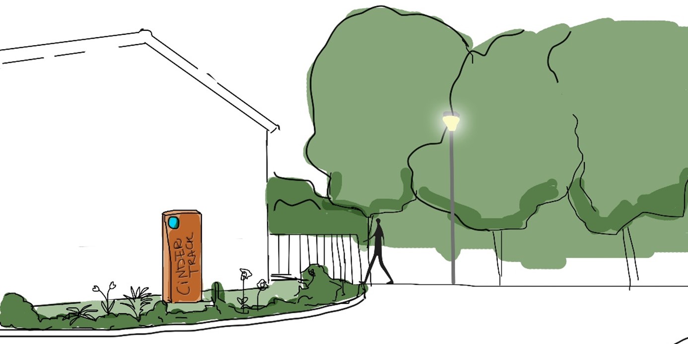
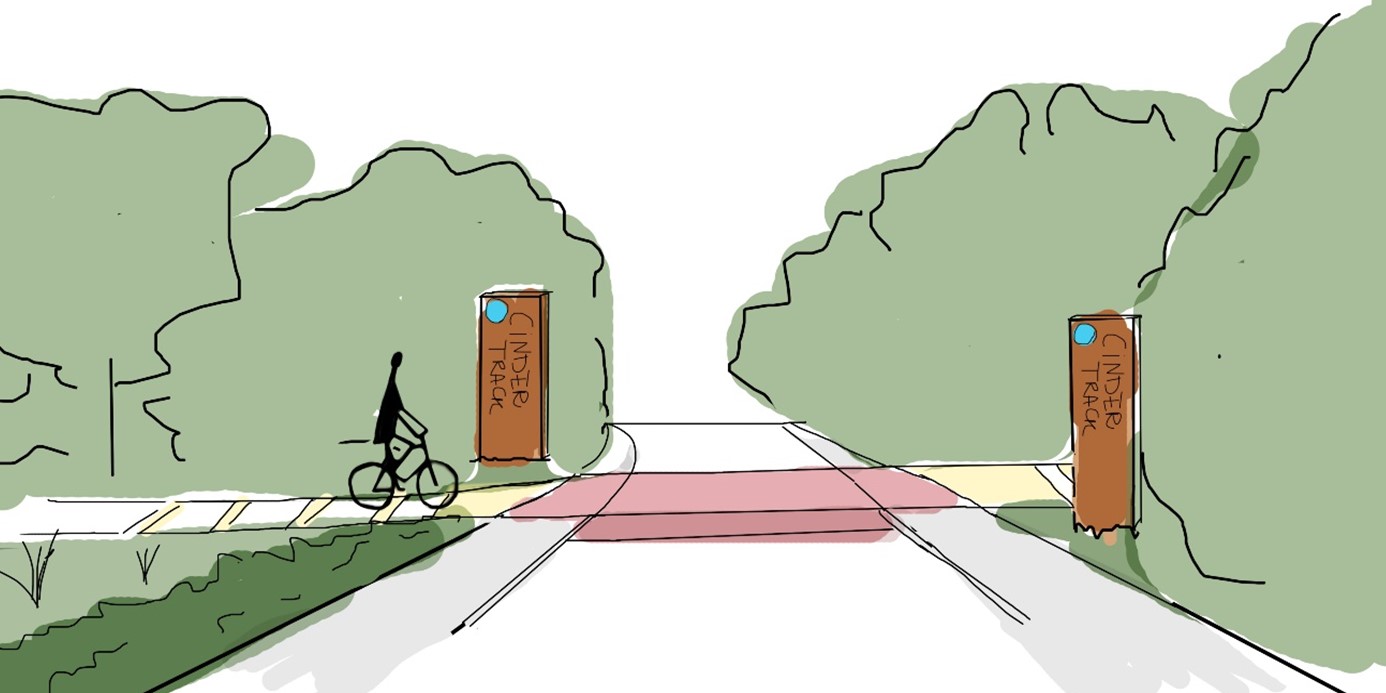
Area 1: Chichester Close
Chichester Close is a gateway to the Cinder Track. This photograph shows that vegetation at the entrance is overgrown and there is little reference to the track, making it difficult for people to know how to access the public right of way.
This design includes a gateway feature drawing attention to the Cinder Track with new ornamental planting. The overgrown vegetation is cut back, and lighting is proposed to provide a more welcoming entrance.
There would also be features at the junction of Station Road and Chichester Close to help signpost people to the Cinder Track.
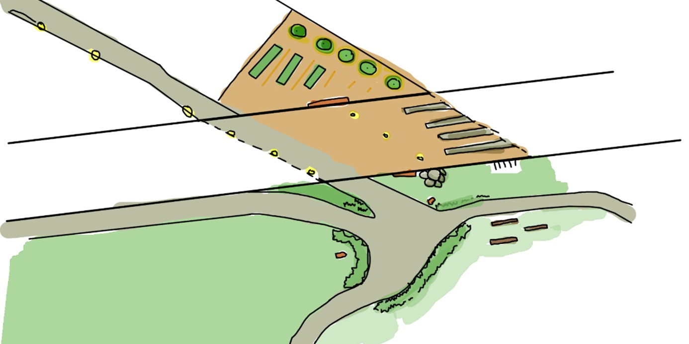
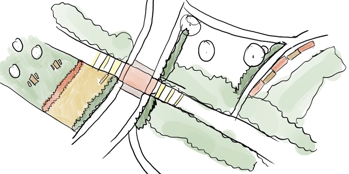
Area 2: Newby Farm
This photograph shows where the Cinder Track crosses Newby Farm Road. The road includes a traffic calming measure and there are gates on either side of the road to access the Cinder Track.
This design takes inspiration from a platform at a train station by providing seating for resting. Information boards provide details about the Cinder Track route and local destination points, just like information boards found on train station platforms.
The design includes a gateway feature referencing the Cinder Track, and a block paved raised table replaces the existing traffic calming measure.
A solar powered surface, designed in bands to look like train tracks, illuminates at night and is positioned on the approach to the junction, to encourage cyclists to slow down.
The gates would also be replaced with chicane gates to ensure it is accessible to everyone, including wheelchairs, mobility scooters and pushchairs, for example.
This aerial view illustrates how the crossing and surrounding space at Newby Farm Road would look. The design includes picnic tables on the grass to provide opportunity to rest. Wildflowers meadows will add further interest and support biodiversity.
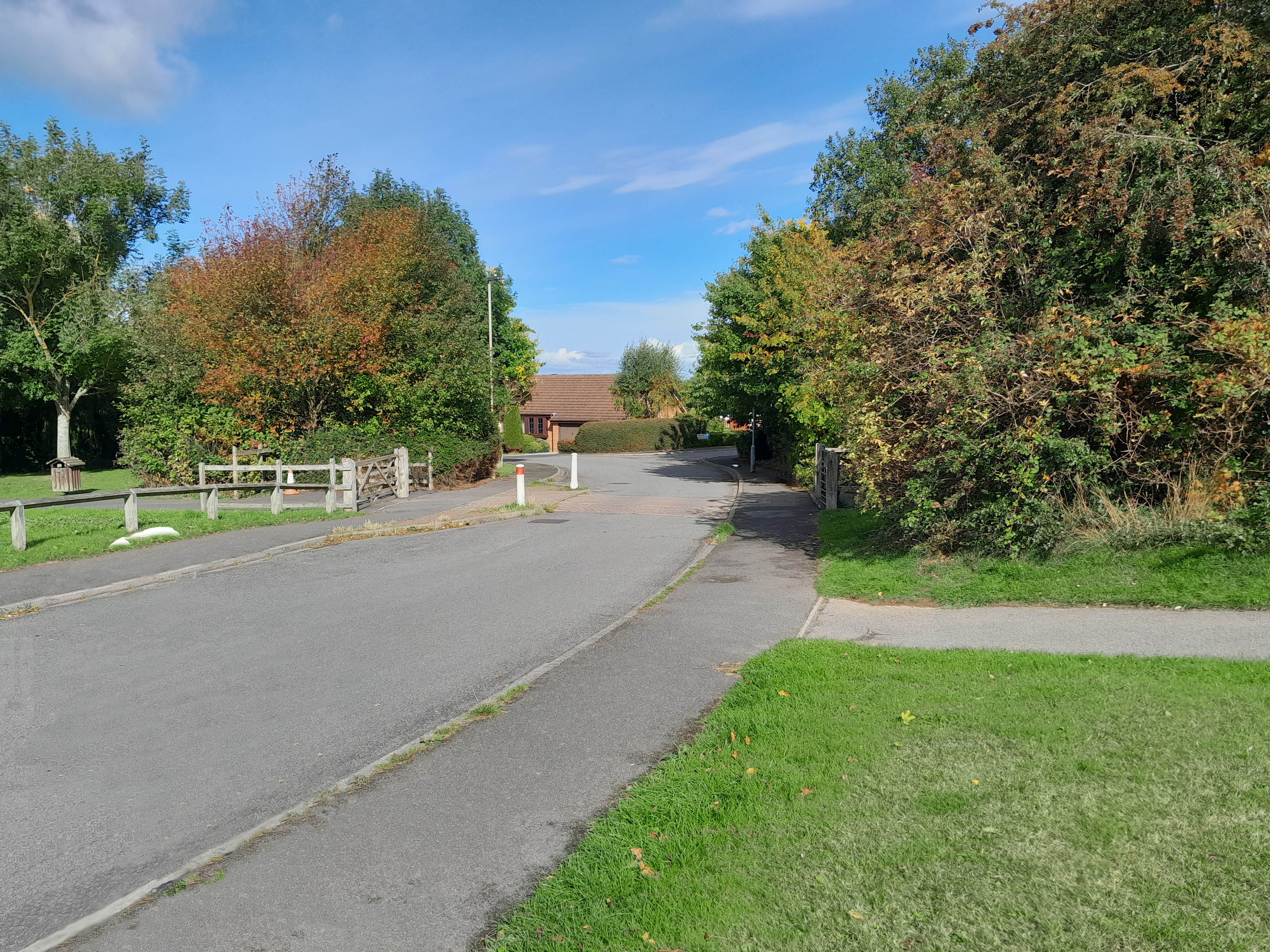
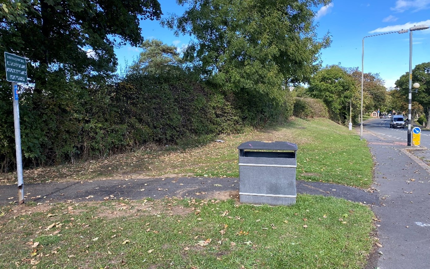
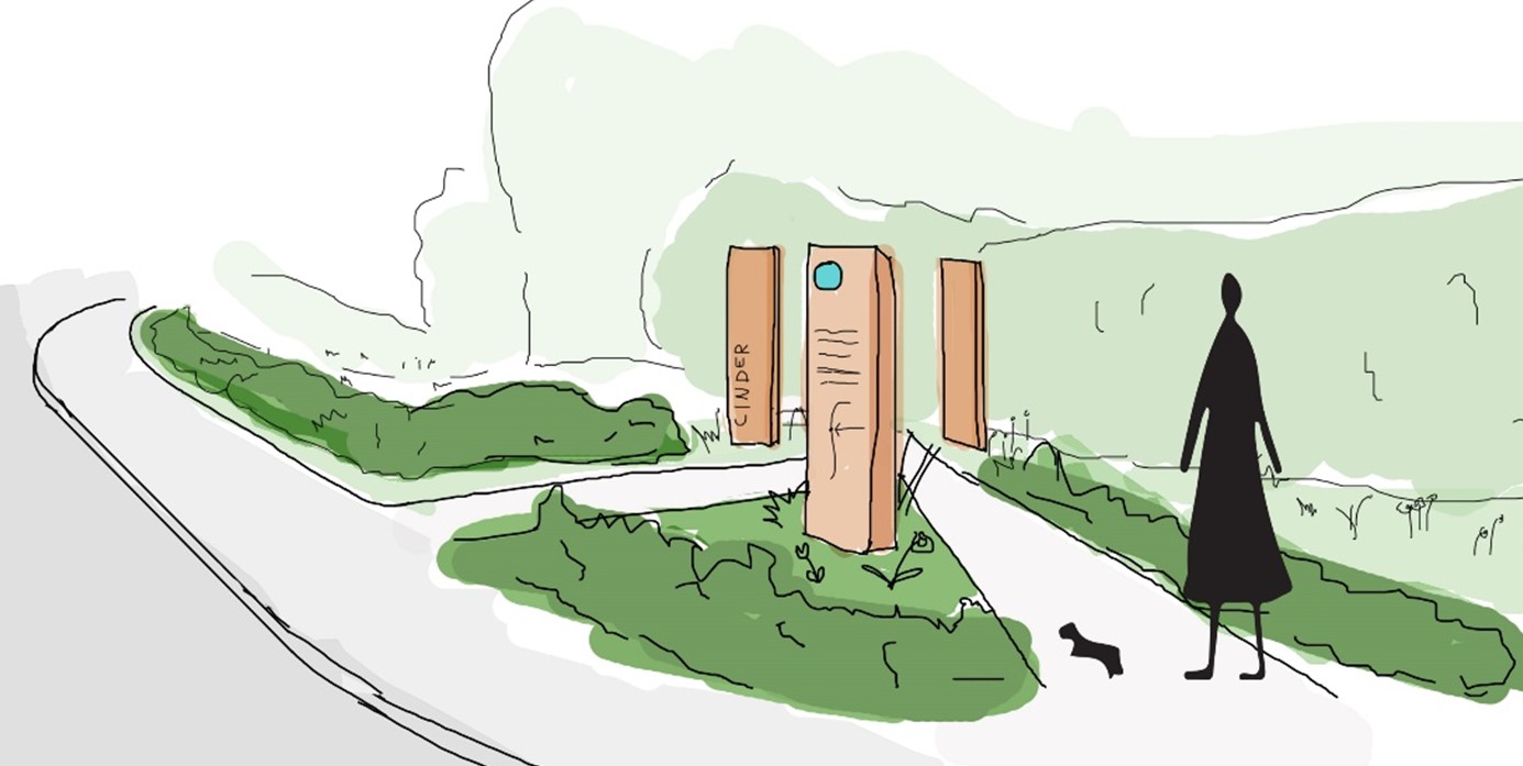
Area 3: Cross Lane
This photograph shows the entrance to the Cinder Track from Cross Lane. There is no obvious reference or branding to highlight the Cinder Track for users. The entrance could benefit from a more welcoming design including Cinder Track branding and planting.
This design illustrates how the gateway to the Cinder Track from Cross Lane (east) would look. Cross Lane is designed as a 'journey' space, an area to travel through that connects to wider destinations.
The design includes ornamental planting and signage that highlights access to the Cinder Track.
This area view illustrates how the entrances to the Cinder Track, from each side of Cross Lane, would look. Both the east and west entrances would include planting and signage that highlights the Cinder Track entrances.
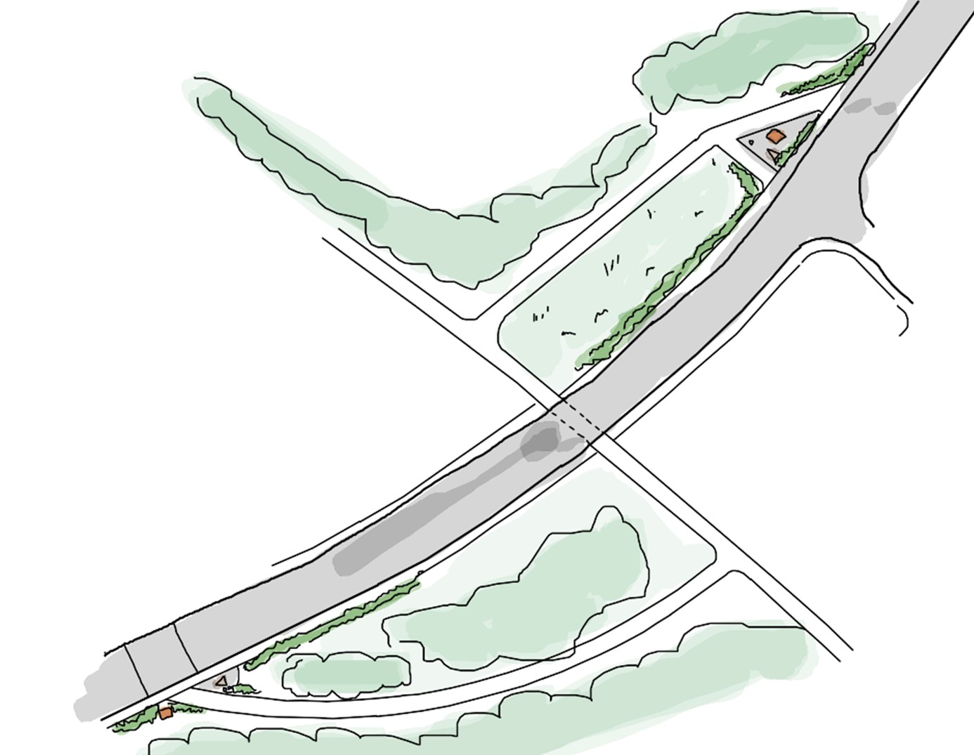
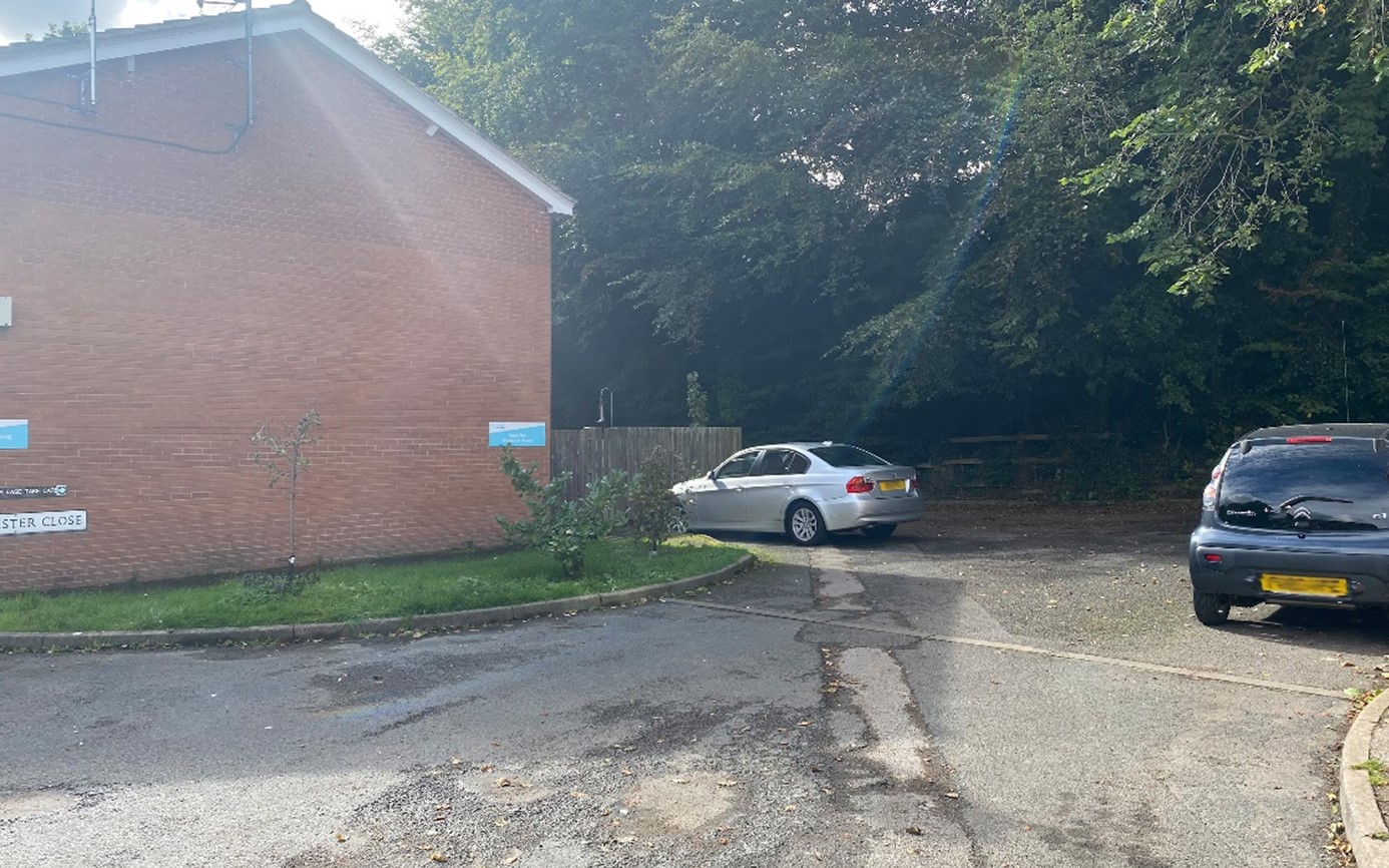
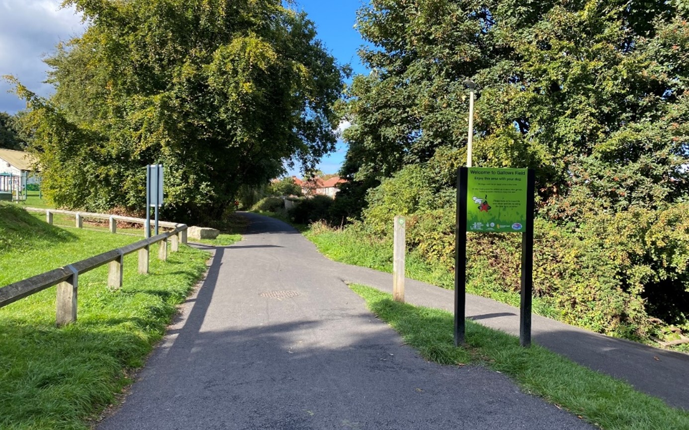
Area 4: Gallows
This photograph shows the intersection of a path leading from a local primary school (right), towards the Gallows Community Centre (left).
Improvements could be made to provide a more welcoming setting and draw attention to the community centre by adding signage and a planting design inspired by the railway.
This design illustrates how the intersection of the Cinder Track would look. The design includes planting, signs and sculptures that tie into the branding of the track. Overgrown vegetation would also be tidied up to provide a more welcoming setting.
This aerial view illustrates how the gateway to the Cinder Track from the Gallows Community Centre and primary school would look. The design includes planting, seating and cycle stands. Electric bike charging points could be introduced to encourage people to travel to the community centre on bike.
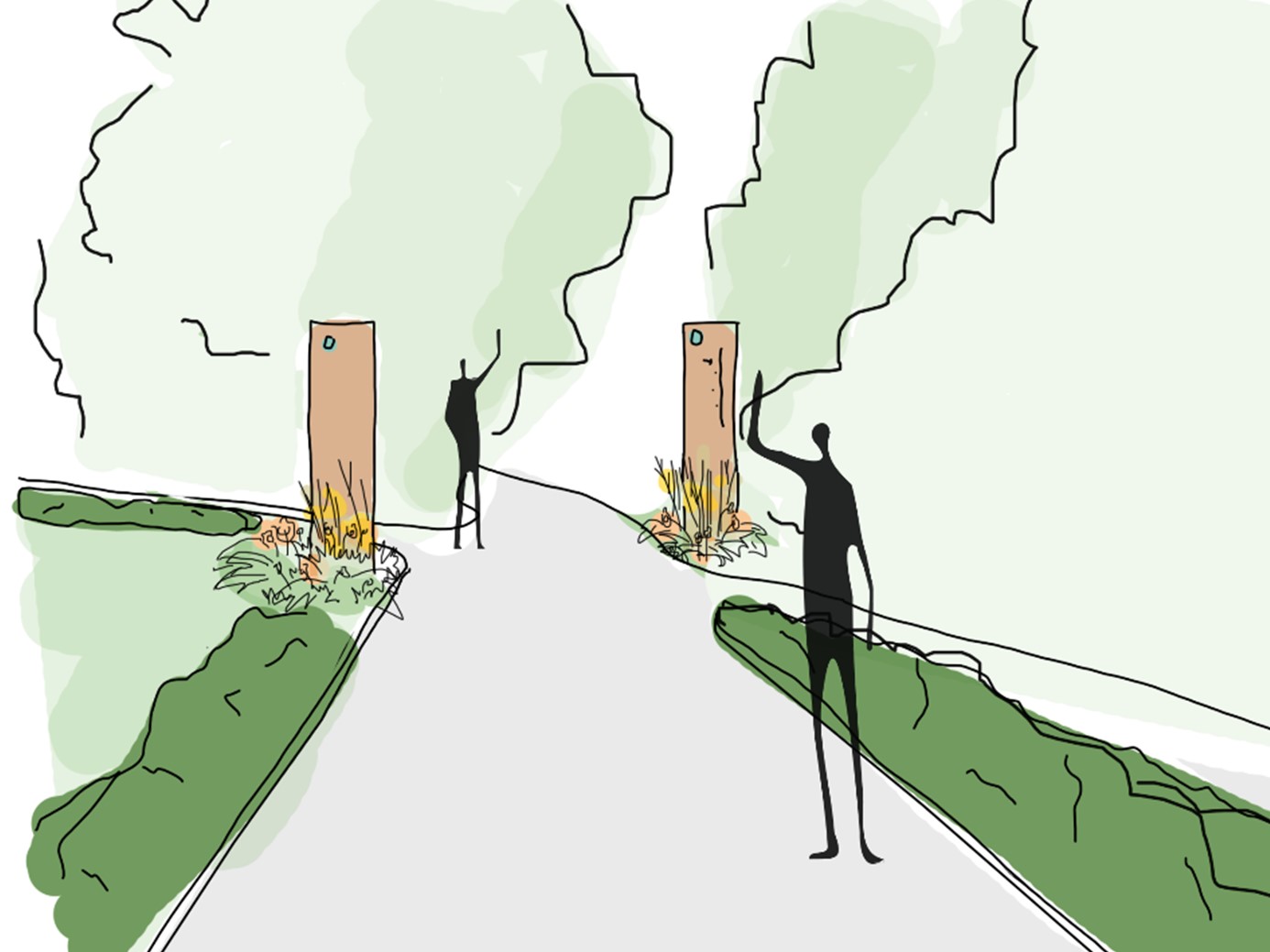
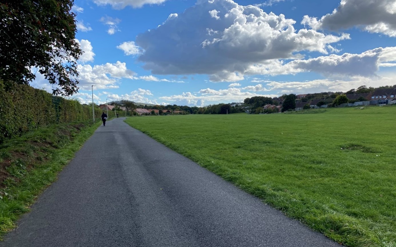
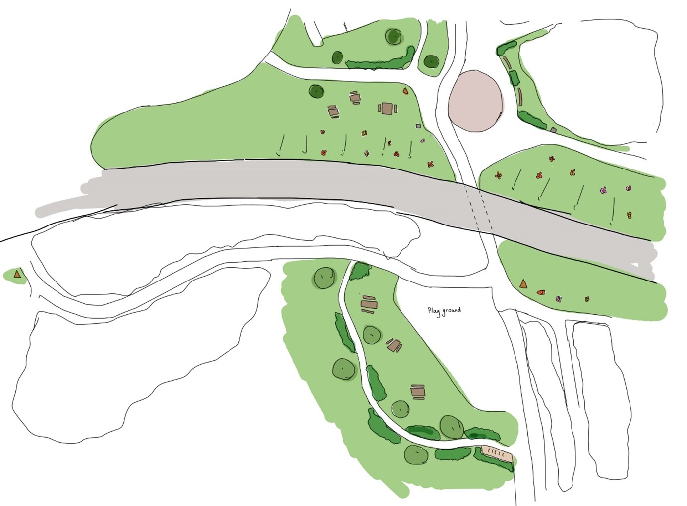
Area 5: Old Carriage Sidings
This photograph shows the site of the historic railway carriage sidings. Now, only a vast open space of underutilised mown grass exists. The space currently lacks purpose and character and has low biodiversity value.
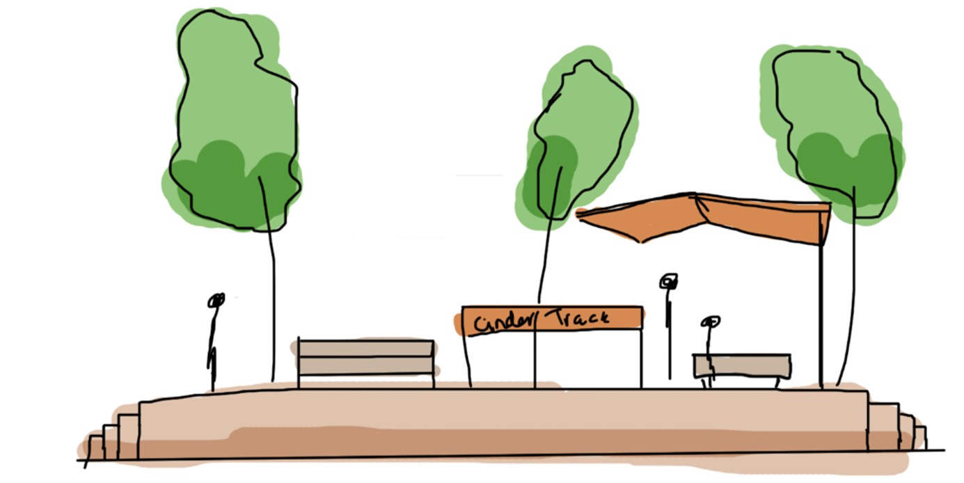
This area view illustrates how the open space across the historic carriage sidings would look. A new surfaced path would be created, following the route of the existing unsurfaced path. Low structures would be built to give the impression of platforms, providing an interactive space and visual interest.
There would also be signage, shelters and seating positioned on them, giving them further purpose. Tree planting and wildflowers in between the hard surfaced areas would add further interest. The existing mound on the east of the path would be dispersed to provide a more natural appearance.
This is a cross section showing what the low built structures design would look like. The idea is that these would look like railway platforms, inspired by train travel and its railway history. Seating, signage and shelters would provide further interest and places to sit and rest.
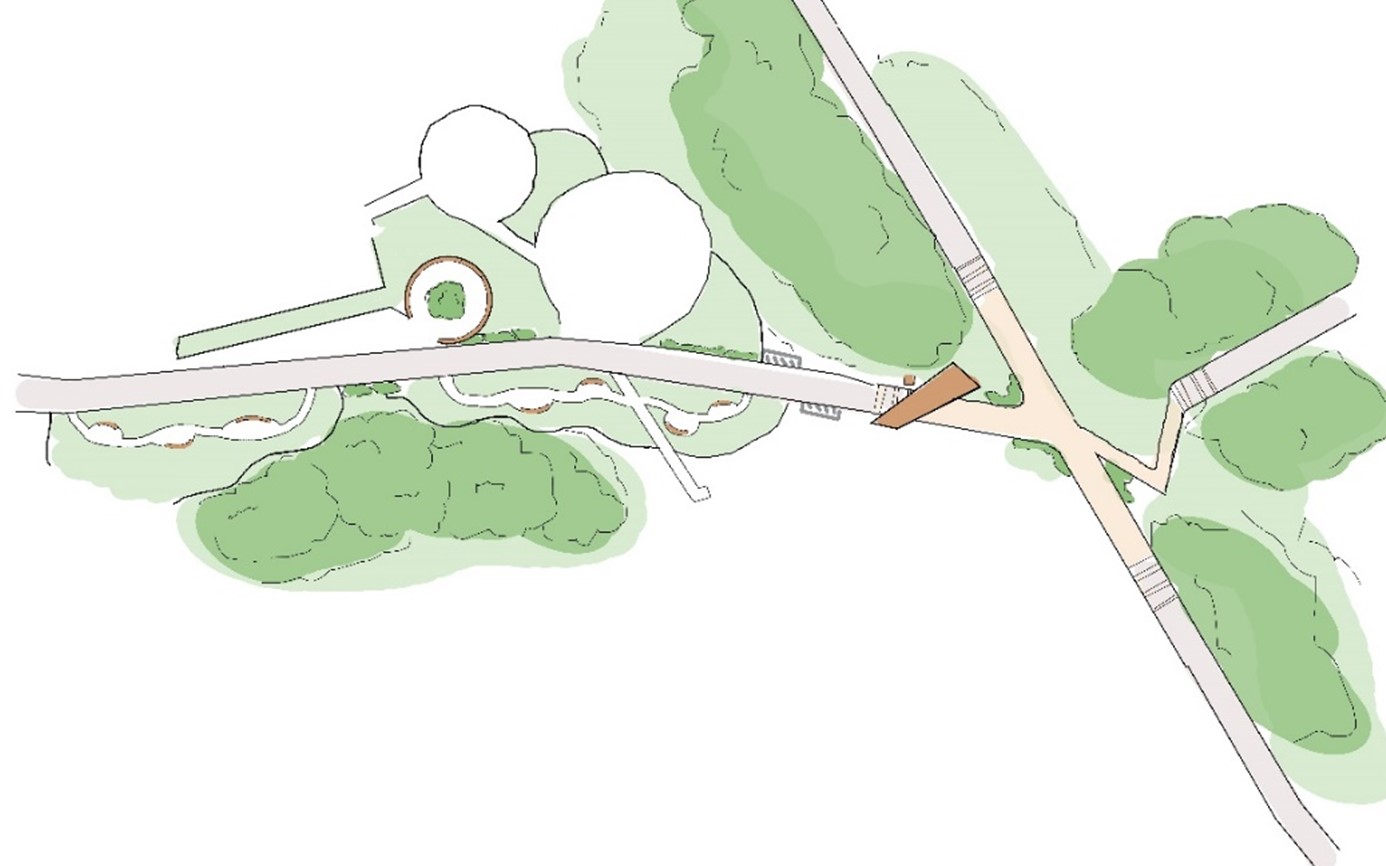
Area 6: Woodland Ravine
This photograph shows the existing paving design and grassed embankments at Woodland Ravine. The space could be improved by refreshing the paving design and introducing biodiversity onto the grassed mounds through bulb and wildflower planting.
The Cinder Track branding would be placed on the underpass parapet, to help people recognise this historic right of way.
This design illustrates how the existing community art paving design would be refreshed. The design would include a solar powered surface that illuminates at night, which would tie into other design areas along this section of the Cinder Track.
Resin bond infill could be introduced into the text to revamp it, making it clear and easy to read once again. The block paving would be cleaned up and strip lighting would be added to highlight the design.
This aerial view illustrates how Woodland Ravine would look. The circular community art paving is to the north, with new benches proposed around it. Picnic tables nearby provide for a quieter resting space.
The grassed embankments would be seeded with wildflowers to increase biodiversity. Additional picnic tables are proposed close to the playground for parents to sit while their children play.
There is an informal path proposed on the southern side of the bridge, edged with ornamental plants and trees. There are cycle racks located here too.
New wayfinding signs would be provided, including to the north and south sides of the bridge parapet for track users, and a third one along Woodland Ravine Road to highlight the Cinder Track.
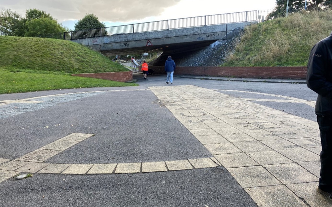
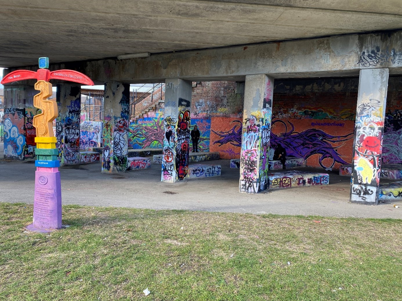
Area 7: Wykeham Street
This photograph shows how underneath the bridge currently looks. There is graffiti on the walls, seating and the pillars. Some of the graffiti is part of an urban art project. The Sustrans millennium sculpture stands on mown grass adjacent to the seating.
This design illustrating how the area would look. Linear low level planting beds and strip lighting in the surfacing are proposed to provide further illumination and resemble the banding of train tracks.
The Cinder Track logo sign would be placed on the underpass parapet, to strengthen the branding of the Cinder Track.
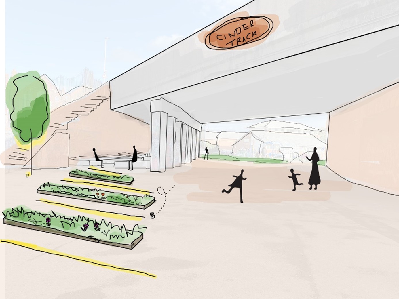
This aerial view illustrates how the Wykeham Street space under the bridge would look.
Ornamental planting is proposed along path edges to create interest and introduce biodiversity. And a light brown resin bonded surface is proposed to provide a warm and simplistic, yet urban feel.
Cycle stands and electric bike charging points could be provided to complement the existing seating and picnic benches near the children’s play areas. Up-lit trees and strip lighting would further enhance the space.
The new resin bonded surfacing, planting, bike racks and ground-level lighting could provide a more refined, safer feeling space, while maintaining its current urban feel.